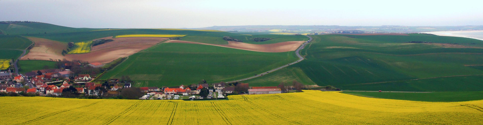
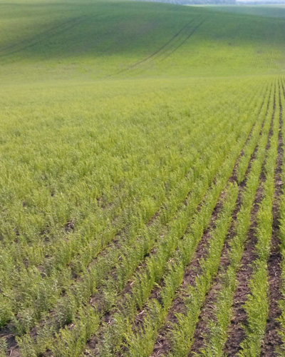
Precision agriculture
PreAgri is an online service for spatial data collection and analysis of agricultural enterprises
PreAgri is an online service for spatial data collection and analysis of agricultural enterprises
PreAgri supports data exchange with field equipment of Raven and John Deere in automatic mode, allows you to make prescription maps for field equipment, determine the actual cost of the brought material, evaluate the quality of completed field works on the map, print reports and export data.
Spatial data collection and analysis of agricultural enterprises
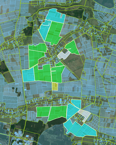
The service allows you to upload objects, images from drones and satellites, provides opportunities for solving spatial tasks, agricultural enterprises, precision agriculture and crop yield monitoring.
collecting all the available spatial data
import data from field equipment
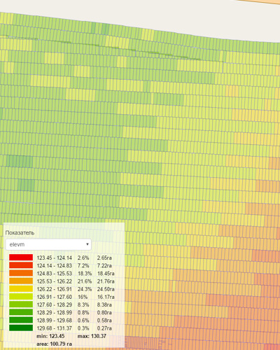
yield analysis
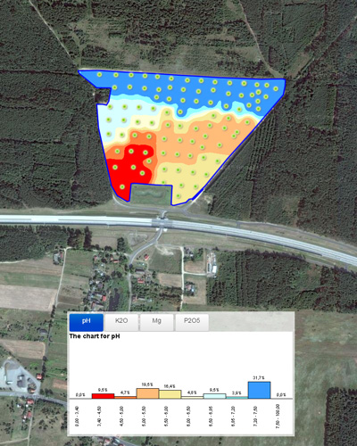
overlay samples agrochemical survey
forming equipment jobs
Online maps of yield, fertilizer, seeding and agrochemical examination
Operational loading data from field equipment and build online maps. Information about loaded into a special layer, then you can perform spatial analysis of any selected index online.
import data obtained during the harvest
create yield maps for selected parameters
mapping of fertilizers and crop yield
calculation of area and number of seeds
monitoring of overlays and passes
Service allows you to import data, create and update objects online using a Web Editor.
Service allows you to create raster and vector layers and automatically generate tiles for quick Web display them on the map. Automatically builds a land card of samples of agrochemical survey of selected indicators.
support for raster and vector layers
online configuring display settings
automatic forming of tiles
mapping of agrochemical survey
Online Editor for spatial data
Connecting GPS trackers and GPS data import. Display map routes together with video.
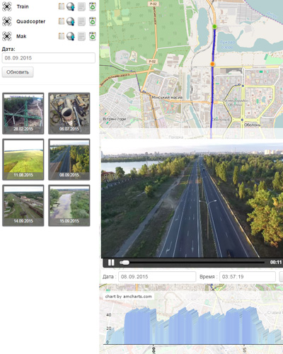
System enables online monitoring of objects, Visual Analytics, calculate mileage and photo-fixing spots on video entering additional information. Synchronization display video with GPS route on the map.
connecting GPS trackers on TCP and HTTP protocols
moving objects in real time
import data in CSV, GPX and KML formats
photo-fixing spots on video
technology Node.js
Our company develops, installs and supports agricultural companies geoportals
Our company helps implement processes to automate complex, precision farming and agricultural processes. Together with our partners we carry out all complex of works on preparation of the data bank, selection of equipment to development and support of geoportals.
development of geoportals for agricultural companies
assistance in the implementation of precision farming
automation of agricultural processes
integration with existing solutions
Web Server Setup and support
Our contacts